In these days of lockdown, each time I look out my kitchen window I am reminded of people moving through the landscape. Like many at the moment, I'm working from home, and am, might I add, lucky to be able to do so. It has its challenges. In my case it's the window with a bit of a view. The mighty River Suck, one of the great and ancient routeways of the West, today, in sunshine, a glistening ribbon below me. Beyond it, a section of the Eiscir Riada rises gently above the callows, heading westwards from a bend in the River and framed by high clouds.
The eiscir or esker, a sinuous series of low hills created approximately ten thousand years ago by melting glaciers, is a physical reminder of the history of people on our island. Many of our modern roads are either built on or next to it. Occasionally it survives intact, such as in Cuillagh and Clonfad. In tandem with the river system, this natural routeway provided access to hunting and fishing grounds and enabled the early population to establish a network of settlements and trade routes. This is supported in part by archaeological finds from the immediate area. Stone tools dating to the Mesolithic (8000-4000 BC) and Neolithic (4000-2500 BC) have been found during archaeological excavations and survey work at Correen Ford, Ardcarne and in Kellysgrove Bog and further west in Barnacragh and Urraghry.

The Eiscir Riada is mentioned in some of the earliest Irish texts and date its use as a routeway to at least the second century AD. According to the Dinnseanchas, or 'the lore of places', the day Conn of the Hundred Battles (Conn Cétchatach) was born, five roads were opened which extended from Tara, the seat of the High Kings to each of the then five provinces. The Slí Mhór or 'Great Road' followed the line of the Eiscir Riada from East to West. The texts also record that the esker was used as a natural boundary. A great battle took place in Maynooth in the year 122 AD between the aforementioned Conn, now High King, and his bitter rival, Eoghan Mór, also called Mogha Nuadhad, who was known for his wisdom and prowess as a warrior. Finally defeated after many bloody battles, Conn was forced to split his kingdom in two equal parts, divided by the Eiscir Riada. The land to the south would be known as Leath Mogha or 'Mogha's half'. Conn retained the land to the north of it (Leath Cuinn or 'Conn's half'), ruled from his seat at Tara.
 |
| The Kellysgrove togher (after Prendergast) |
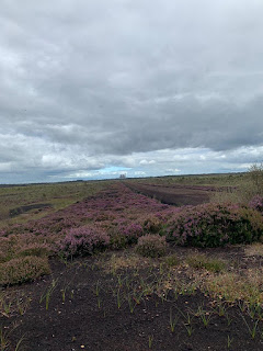
In time, as the population expanded, other roads were constructed, some of which have been re-discovered in the bogs across the Midlands. One of the closest known examples to us was found in 1946 in Kellysgrove Bog, part of which was investigated by Ellen Prendergast from the National Museum in August of that year. It consisted of a narrow trackway or togher constructed from horizontal timbers overlying a brushwood and gravel base. Dated to the medieval period, it was suggested that the togher linked the monastic site of Clontuskert with the Teampólín in Pollboy. As the monastic settlements were centres of population and industry in early medieval Ireland, the togher at Kellysgrove may be indicative of wider links with places such as Clonmacnoise and Kilbegly. It's highly likely that the togher formed part of the road network on the Roscommon side of the river, accessed from one of the fording points on the Suck. Up until modern times a ford, which was passable apparently with a horse and cart, was located at the bend in the river between Tulrush and the now demolished Mill in Pollboy. The ford undoubtedly has much older origins and is reputed to have been the crossing point for the armies during the Battle of Aughrim in 1691.
And so, to go back to the beginning. If you think about all those who have crossed these lands before us, followed routes, climbed hills, stopped to take in the view or have a bite to eat, survived plague, battle and famine, rest assured that in time, we will be able to walk in their footsteps and go out into the world ourselves again.
'My eyes already touch the sunny hill, going far ahead of the road I have begun.' Rainer Maria Rilke 'A Walk'
Refs.
O'Donovan, J. 1847 The book of Rights. The University Press.
Prendergast, E. 1946 Togher at Kellysgrove, Co. Galway. Journal of the Galway Archaeological and Historical Society Vol. 22, 15-18.


